


Beaufortain étape 2

Roger Philippe Wallez
User GUIDE
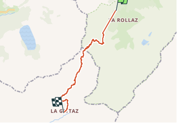

Length
10 km

Max alt
2373 m

Uphill gradient
683 m
Km-Effort
19.4 km

Min alt
1662 m

Downhill gradient
769 m
Boucle
No
Creation date :
2025-07-22 07:03:23.0
Updated on :
2025-07-22 16:33:30.876
6h25
Difficulty : Very difficult

FREE GPS app for hiking
 SityTrail
IGN / Geographical institutes
SityTrail Plus
The world is yours!
About
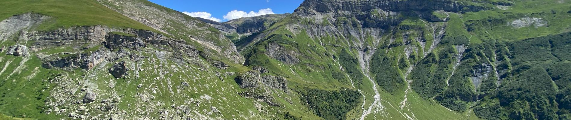
Trail Walking of 10 km to be discovered at Auvergne-Rhône-Alpes, Upper Savoy, Les Contamines-Montjoie. This trail is proposed by Roger Philippe Wallez.
Photos


Positioning
Country:
France
Region :
Auvergne-Rhône-Alpes
Department/Province :
Upper Savoy
Municipality :
Les Contamines-Montjoie
Location:
Unknown
Start:(Dec)
Start:(UTM)
322028 ; 5071348 (32T) N.
Comments